Seminole Hills Plantation
In the 1920s Seminole Hills was the largest plantation in Bay County, FL. In 1927 it had grown to 150 houses and had a post office, school, commissary, hotel and a church. Unfortunately, the town disappeared shortly after the stock market crash in 1929, which halted funding and business in the town. Historic flooding in 1929 and the Bahamas hurricane could have contributed to the town's demise. In 1930 the post office closed and the land was auctioned off. No trace of the town remains, except a few nondescript dirt roads.
GPS coordinates are: 30.370355, -85.933535
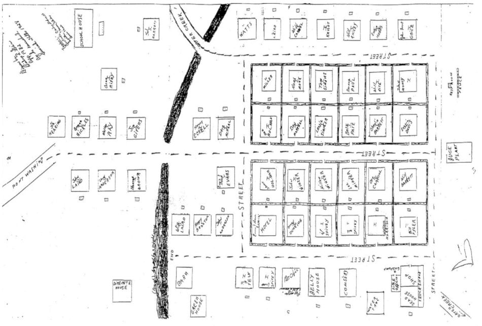
A hand drawn map of Seminole Hills Plantation as it was in 1928:
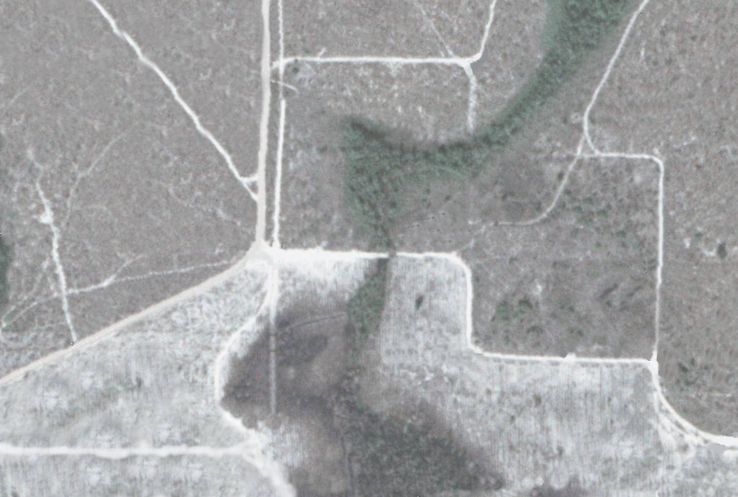
A current satellite image of Seminole Hills Plantation:
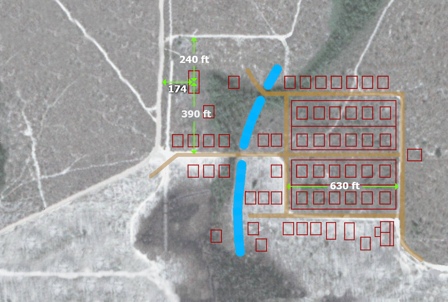
An overlay of the hand drawn map on the satellite image:
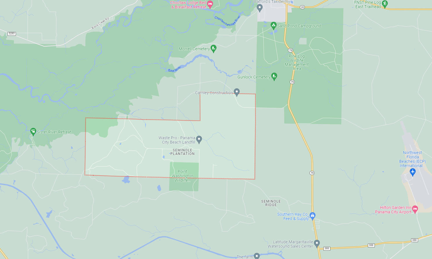
A wide area map of Seminole Hills Plantation:
Contact
If you have questions, comments or suggestions please contact me at kevin@kevinsworkbench.com